

Appearance
Projects
The Projects page is used to create, delete and download projects. Projects that contain GPS data can be plotted and inspected on a map.
A description of the map controls and buttons can be found on the survey page.
Project List
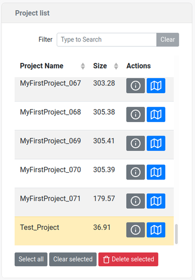
The currently active project is shown in a yellow highlight.
Info
Note
The maximum project size is 300 MB, if this limit is exceeded, the project is split internally. This only affects the way projects are downloaded. When this occurs, the download button will open a pop-up where the project can be downloaded in parts. Split parts are appended by a number in the format _xxx
Create new project
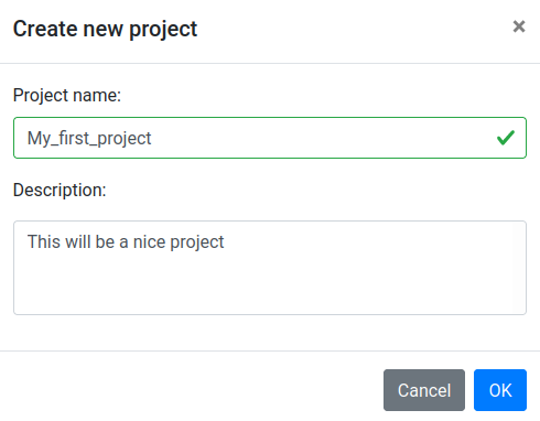
Clicking the New Project button will open up a pop-up where a project name and description can be inserted.
| Entry | Description |
|---|---|
 | Open the project creation tab |
| Project name | The name of the project. Note that the names have to be at least 3 characters long, contain only a-z, A-Z, 0-9 and the _ character. If the project name already exists the creation will generate an error. |
| Description | A text description of the project (optional, can be blank) |
Project info
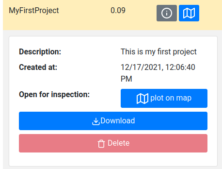
By clicking on the info button of a project, the project can be inspected, downloaded and deleted.
| Entry | Description |
|---|---|
 | This button will open up the project inspection tab |
 | This button will plot the project on the map |
| Description | The description of the project given when creating a project |
 | Download the project. When downloading a project, the data files associated with the project are zipped and then transferred to the user. This zip files contains the .JSON files that can be loaded and reanalyzed by Gamman. Depending on the sensors present in the system and the actions done by the user, a number of additional files can be present. The contents of these files are described in the table below. The georeferenced concentrations.csv can be downloaded manually by using the dropdown option. See the table below for a description of the contents of this file. |
| Sub projects | If the project size exceeds 300 MB, the data is internally split into sub projects. When the download button is pressed a window will open that shows the sub project present and each sub project can be downloaded manually. Split parts are appended by a number in the format _xxx. |
 | Delete the project. Note that the currently selected project cannot be deleted. |
Project download
The table below describes all the (optional) files in a full project download.
| Filename | Created by | Description |
|---|---|---|
| <year><month><day>T<time><project_name>.json | The detector | This file contains all the data recorded by the sensor. This includes raw data of all the sensors, but also processed and synchronized JSONS, samples and indicators when the sensor was paused. |
| concentrations.csv | The detector, when valid GPS positions and radionuclide concentrations are recorded | A CSV file with georeferenced radionuclide concentrations. The contents of these file are the points plotted on the map shown on the projects page. The radionclide concentrations in this file are found by analyzing the spectra by using the spectral processing settingsthat were selected when the data was recorded. |
| .DIRBIRTH | The detector | A file used by the detector to track when the project was created |
| unitsReadme.txt | The detector | A readme file that indicates the units of the radionuclide concentrations in the concentrations.csv file (Bq/kg, PPM or PPM oxides) |
| suggestedSampleLocations.csv | The user | A JSON containing the suggested sample locations in a project. These are created by using the find locations function. |
| samples.json | The user | A JSON containing the sample measurements present in a project. These are created by using the measure sample function. |