

Appearance
Drone borne test of MS-350, MS-1000 and MS-2000
This page contains the data that is described in the scientific publication Optimizing gamma-ray spectrometers for UAV-borne surveys with geophysical applications published in the journal of environmental radioactivity: https://doi.org/10.1016/j.jenvrad.2021.106717
The article is an open-access article and, therefore, accessible without a license.
The table below contains the data used in this publication in a CSV format. The table below
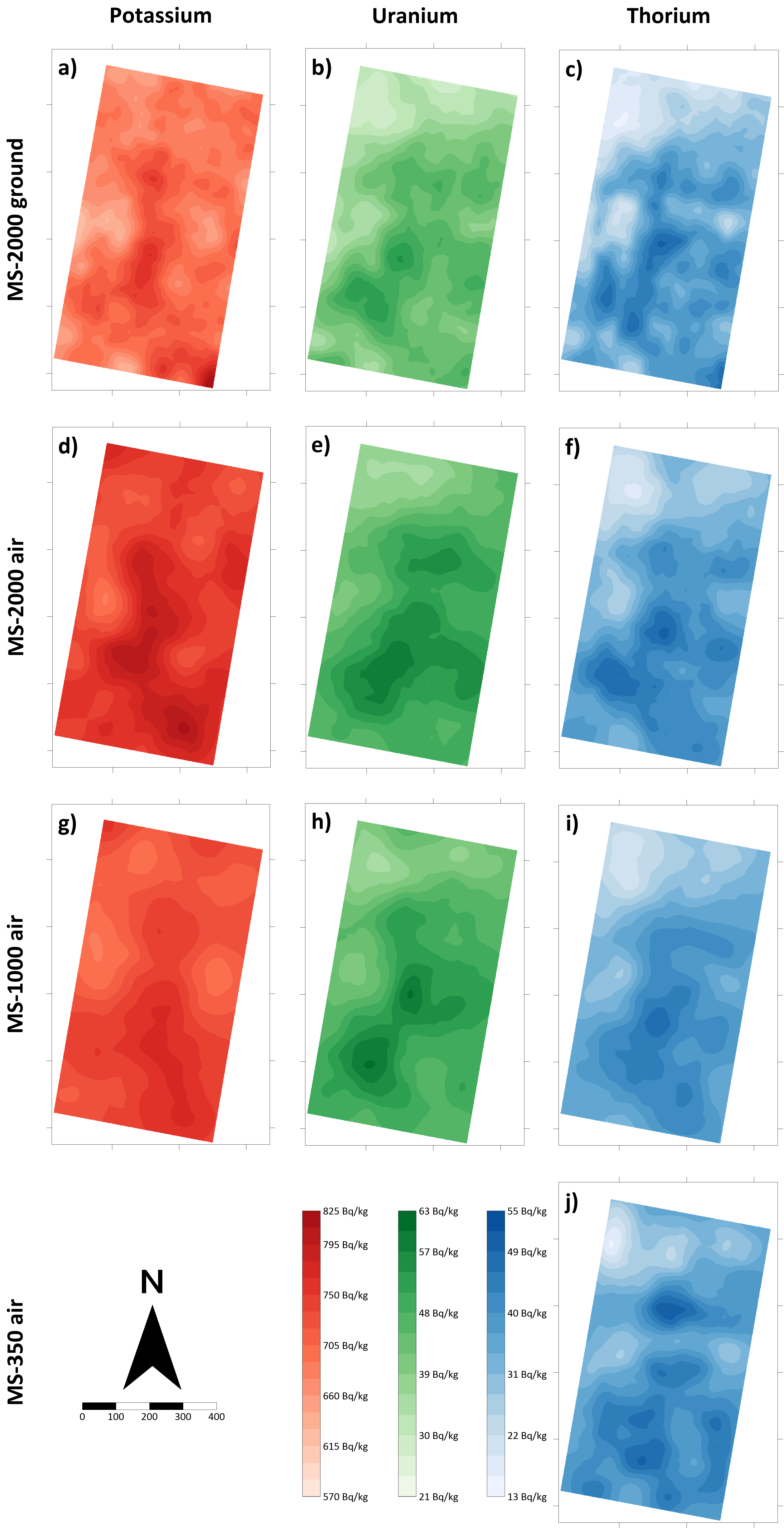
This article compares the results of three different sizes of Medusa gamma-ray spectrometers mounted on a drone with each other and with a ground-borne measurement in an agricultural field. The latter is chosen because agricultural fields have a relatively low radionuclide concentration, and therefore, the methodologies used in the article will also work in environments where the soil contains higher radionuclide concentrations.
The article concludes that you can use a detector as small as the MS-350 for environmental mapping of radionuclide concentrations in a field if you optimize the data processing and map-making process by using Full Spectrum Analysis (FSA) and Kriging.
CSV Data
| Description | File | Measurement height |
|---|---|---|
| MS-2000 ground-borne data | Demo_data_MS2000_0.8m-Detector_Comparison.csv.csv | 0.8 m |
| MS-2000 UAV-borne data | Demo_data_MS2000_20m-Detector_Comparison.csv.csv | 20 m |
| MS-1000 UAV-borne data | Demo_data_MS1000_20m-Detector_Comparison.csv | 20 m |
| MS-350 UAV-borne data | Demo_data_MS350_20m-Detector_Comparison.csv | 20 m |
Header description
The CSV files in the table above contain a single data point in each row. The header gives a description of the data, and the table below gives a detailed description of the values present in the CSV files.
| Name | Description |
|---|---|
| Date | Date in day/month/year format |
| Time | Time in hour:minute:second format |
| X_GPS | X-position in WGS-84 coordinate system |
| Y_GPS | X-position in WGS-84 coordinate system |
| Z_GPS | GPS height of the measurement |
| Latitude_GPS | Latitude coordinate of the measured value |
| Longitude_GPS | Longitude coordinate of the measured value |
| Total_counts | Total counts present in the spectrum (counts) |
| Cosmics | Counts in the cosmic channel (energy > 3 MeV) |
| 40-K | Radionuclide concentration of potassium-40 in Bq/kg |
| 238-U | Radionuclide concentration of uranium-238 in Bq/kg |
| 232-Th | Radionuclide concentration of thorium-232 in Bq/kg |
| S 40-K | Uncertainty in the radionuclide concentration of potassium-40 in Bq/kg |
| S 238-U | Uncertainty in the radionuclide concentration of uranium-40 in Bq/kg |
| S 232-Th | Uncertainty in the radionuclide concentration of thorium-40 in Bq/kg |
| Height | Height of the measurement point as measured by the on-board lidar (only present in the UAV datasets) |