

Appearance
Recommended survey parameters
Determining the optimal height, line spacing, and speed is not straightforward. In general, flying lower, slower, and with tighter line spacing improves spatial and point resolution. However, the ideal parameters depend on several factors, including ground concentration levels, the required spatial and point resolution, and available operational resources.
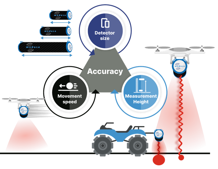
A common approach is to use a two-phase survey strategy: begin with a coarse survey at higher altitude and speed to identify areas of interest, then follow up with a second, more detailed survey at lower altitude and slower speed. Our sensors provide immediate in-field results, making this two-step method practical and efficient.
The table below suggests some initial values, which can be refined based on preliminary results and specific field conditions.
Drone survey parameters
| Detector | MS-1000 | MS-700 | MS-350 | MS-100 (anthropogenic) |
|---|---|---|---|---|
| Mapping Speed | < 30 km/h (< 8.4 m/s) | < 20 km/h (< 5.6 m/s) | < 15 km/h (< 4.2 m/s) | < 10 km/h (< 3 m/s) |
| Flying height | 5 - 30 m | 5 - 25 m | 1 - 20 m | 1 - 40 m |
| Line distance | 5 - 30 m | 5 - 25 m | 1 - 20 m | 5 - 20 m |
| Analysis frequency | 0.33 hz | 0.25 hz | 0.2 hz | 0.3 hz |
Vehicle Survey parameters
| Detector | MS-2000 | MS-7300 |
|---|---|---|
| Mapping Speed | < 45 km/h (< 12.5 m/s) | < 45 km/h (< 12.5 m/s) |
| Measurement height | 0.8 m | 0.8 m |
| Line distance | 5 - 20 m | 5 - 20 m |
| Analysis frequency | 0.33 hz | 0.2 hz |
Airborne Survey parameters
| Detector | MS-4000 | MS-20k |
|---|---|---|
| Mapping Speed | < 90 km/h (< 25 m/s) | < 120 km/h (< 33.3 m/s) |
| Measurement height | 60 - 120 m | 60 - 120 m |
| Line distance | 50 - 100 m | 50 - 250 m |
| Analysis frequency | 0.33 hz | 1 hz |